
Uplifting a school infrastructure digital twin.
User research and strategic redesign to make a school infrastructure digital twin more coherent and usable, with design support through implementation.
At a glance
- Bring legacy information together in an experience that supports different users and levels of spatial knowledge.
- User research, workflow and interface design, stakeholder engagement and implementation support.
- Research-led priorities and a coherent Esri experience aligned with the enterprise design system.
- Proof of concept through redesign and implementation support.
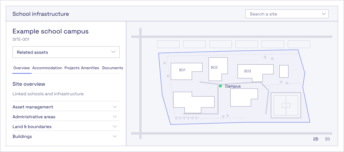
Illustrative reconstruction; client identity, locations and data have been anonymised.
The full case study continues below
The context
A school infrastructure digital twin was being developed to bring information from multiple legacy systems into a single spatial product.
The initial proof of concept demonstrated the potential of the technology, but it was considered difficult to understand and use. It did not reflect the organisation’s enterprise design system and required significant uplift before it could support broader adoption.
The team needed a stronger understanding of its users, a clearer product direction and an experience that worked for people with different responsibilities and levels of spatial and data knowledge.
Learning from the people using it
We conducted research with users and stakeholders to understand how school infrastructure information was accessed, interpreted and used in practice.
This uncovered different needs, workflows and levels of technical confidence across the organisation. It also showed where existing systems created friction and where bringing information together could support better, more efficient decisions.
The research gave the team an evidence base for deciding what the product needed to support, not simply which features it could contain.
Redesigning around real work
We used the research to reconsider the product’s structure, workflows and interface.
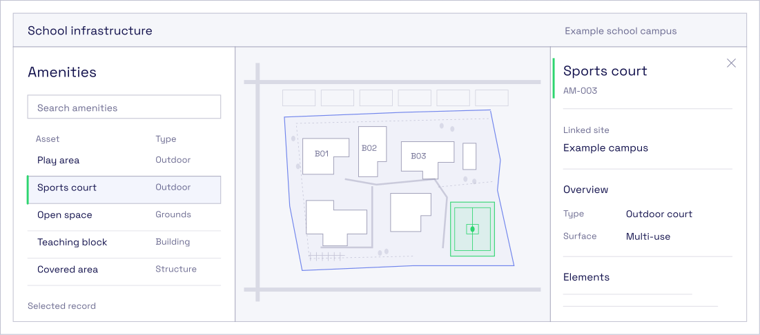
The redesign focused on helping people find relevant information, understand the context around a school or asset and complete important tasks without requiring specialist spatial, system or data knowledge.
We brought user needs, spatial information and organisational priorities together within a more coherent product experience, while accounting for the capabilities and constraints of the Esri environment.
The interface was also aligned with the organisation’s enterprise design system so the product felt like part of its wider digital ecosystem rather than a separate GIS application.
Leading the design through implementation
We remained closely involved as the redesign moved through stakeholder review, approval and development.
This included communicating the direction across the organisation, working with the business analyst and developers, resolving implementation questions and adapting designs when technical or organisational constraints emerged.
Staying close to delivery allowed the product to evolve without losing sight of the research, user needs or wider design direction.
What the work established
- User and stakeholder research
- Evidence-based product priorities
- Redesigned workflows and information architecture
- UX and interface designs for a custom Esri application
- Alignment with the enterprise design system
- A clearer relationship between spatial data and user tasks
- Stakeholder communication and design approval support
- Close collaboration with business analysis and development
- A stronger foundation for production rollout
